Construction Documentation
Every phase, captured. Every stakeholder, informed.
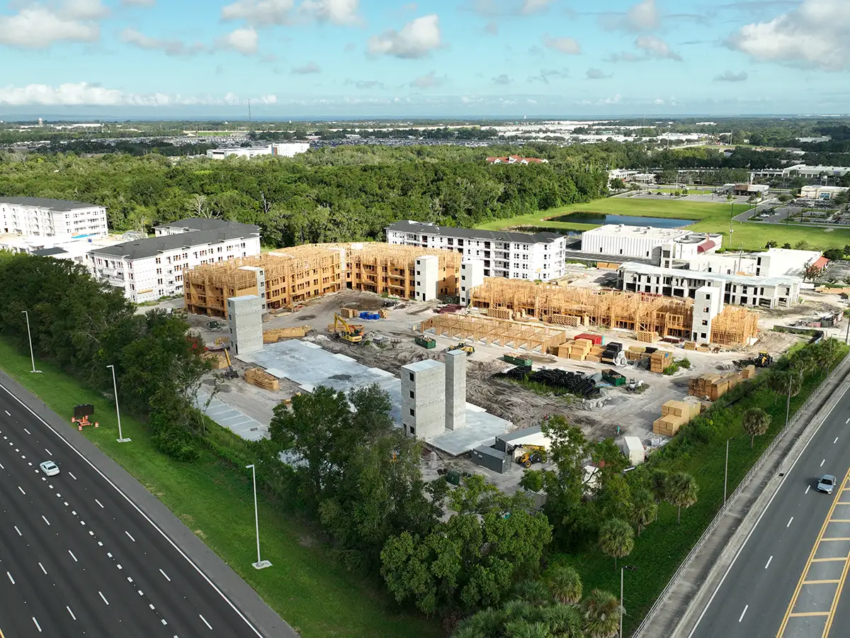
Aerial and ground documentation for commercial construction. We capture your jobsite from the angles a site walk misses, then turn it into a board-ready report within 48 hours.
Aerial and ground visual records
Skyland Pixels delivers comprehensive aerial intelligence, on the ground documentation, and 3D site context for every project. From the first stake to the final punch list, you have a clear record of what was built, when, and by whom.
High-resolution site photography
Nadir and oblique aerial views, ground-level walkthroughs, and detail shots of installed systems. Every image is geo-tagged and time-stamped.
Board-ready photo reports
A formatted PDF with our observations, the captured phase of work, and any issues we noticed. Delivered within 48 hours of the visit.
Lender and insurance documentation
Dated, geo-referenced visuals that support draw requests, claims, and dispute resolution. We have helped clients in both.
Marketing-ready media
Professional aerial and ground photography suitable for project marketing, owner presentations, and community relations.
Our four-step process
Consult & Plan
Project goals, site conditions, schedules, reporting needs. We align on deliverables from day one.
Capture & Analyze
FAA-certified team, advanced aerial tools, geo-tagged data, jobsite safety protocols.
Process & Deliver
Photo report, raw image archive, optional 3D model or orthomosaic. Tailored to your stakeholders.
Support & Update
Phased updates, reporting help, and a real point of contact for the duration of the project.
Frequently asked questions
What does a documentation visit include?
Pre-flight planning and permissions. Aerial and ground photography. Geo-referenced stills. A written narrative of what we observed. A board-ready photo report within 48 hours.
How often do you visit?
Most projects use weekly or monthly scheduled flights. One-time site captures are available for milestone documentation, lender deliverables, or pre-bid surveys.
What deliverables do we get?
Stakeholder photo report (PDF), raw hi-res image archive, geo-tagged orthomosaic (optional add-on), 3D model (optional add-on), and time-lapse clips.
Do you fly in active construction conditions?
Yes. We hold a current FAA Part 107, OSHA-10, and $1M aviation liability. Active jobsite protocols, crew coordination, and PPE are part of the standard workflow.
Ready to see your project differently?
A documentation visit is the fastest way to know what's happening on your jobsite.
Book a Free Site Assessment