3D Modeling & Reality Capture
The site, captured in 3D. The data, ready for your tools.
Aerial photogrammetry produces orthomosaics, point clouds, and textured 3D meshes with 1-3 cm accuracy. Files drop into AutoCAD, Revit, Civil 3D, Pix4D, and Virtual Surveyor.
Book a Free Site AssessmentPhotogrammetric reality capture
From a single aerial flight, we generate high-resolution orthomosaics, dense point clouds, textured 3D meshes, and digital surface models. Survey-grade accuracy, on demand.
Orthomosaics
Site-wide, same scale, north-up. Your base layer for every decision. Geo-referenced and ready to load.
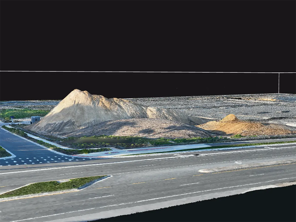
Point clouds and meshes
Dense point clouds and textured 3D meshes for design review, stakeholder communication, and as-built verification.
DSMs, DTMs, and contours
Digital surface models, terrain models, and contour lines for grading, cut/fill analysis, and design verification.
Stockpile volume calculations
Cut/fill volumetrics, stockpile measurements, and material tracking with 1-2% accuracy.
Frequently asked questions
What deliverables do you produce?
High-resolution orthomosaics, dense point clouds, textured 3D meshes, digital surface models (DSMs), digital terrain models (DTMs), and contour lines. We can also produce stockpile volume calculations.
What formats do you support?
Standard formats: GeoTIFF, LAS, OBJ, FBX, DXF, KML, and Cesium 3D Tiles. We deliver files that drop into AutoCAD, Revit, Civil 3D, Pix4D, Virtual Surveyor, and RealityCapture.
How accurate is the 3D model?
Horizontal accuracy of 1-3 cm and vertical accuracy of 2-5 cm is typical for our photogrammetric models, with GCPs when required. We can match survey-grade accuracy on request.
Do you offer ground control points (GCPs)?
Yes. We coordinate with licensed surveyors for GCPs when survey-grade accuracy is required, or fly direct geo-referencing for most commercial projects.
Capture your site in 3D
1-3 cm accuracy. Standard file formats. 48-hour turnaround.
Book a Free Site Assessment