Aerial Intelligence for Construction
Stop guessing.
Start documenting.
We produce the visuals and the stakeholder report so your team doesn't have to. Aerial photography, time-lapse, and 3D documentation for commercial construction throughout Central Florida.
Trusted by Orlando's Leading Construction & Surveying Professionals


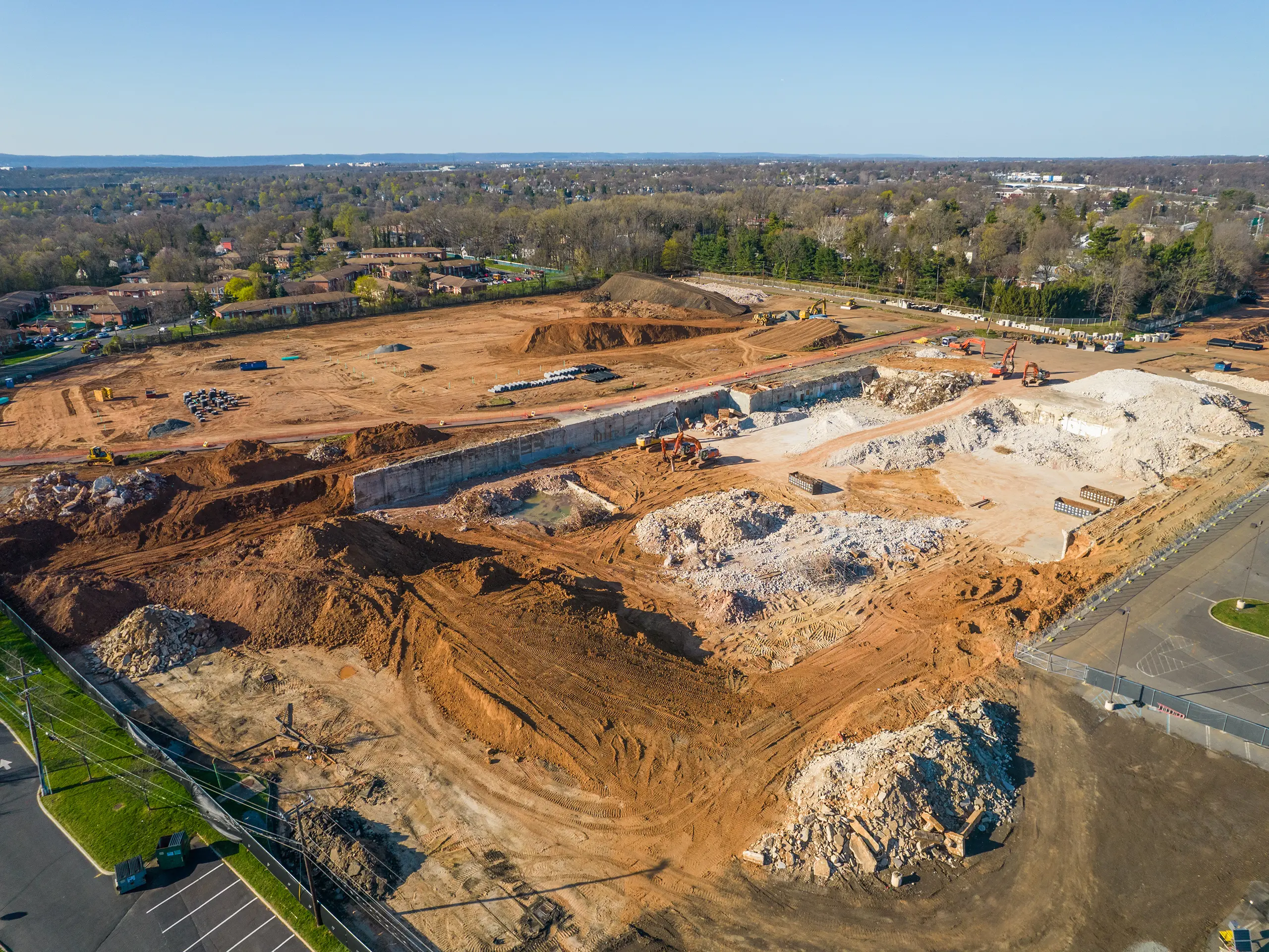
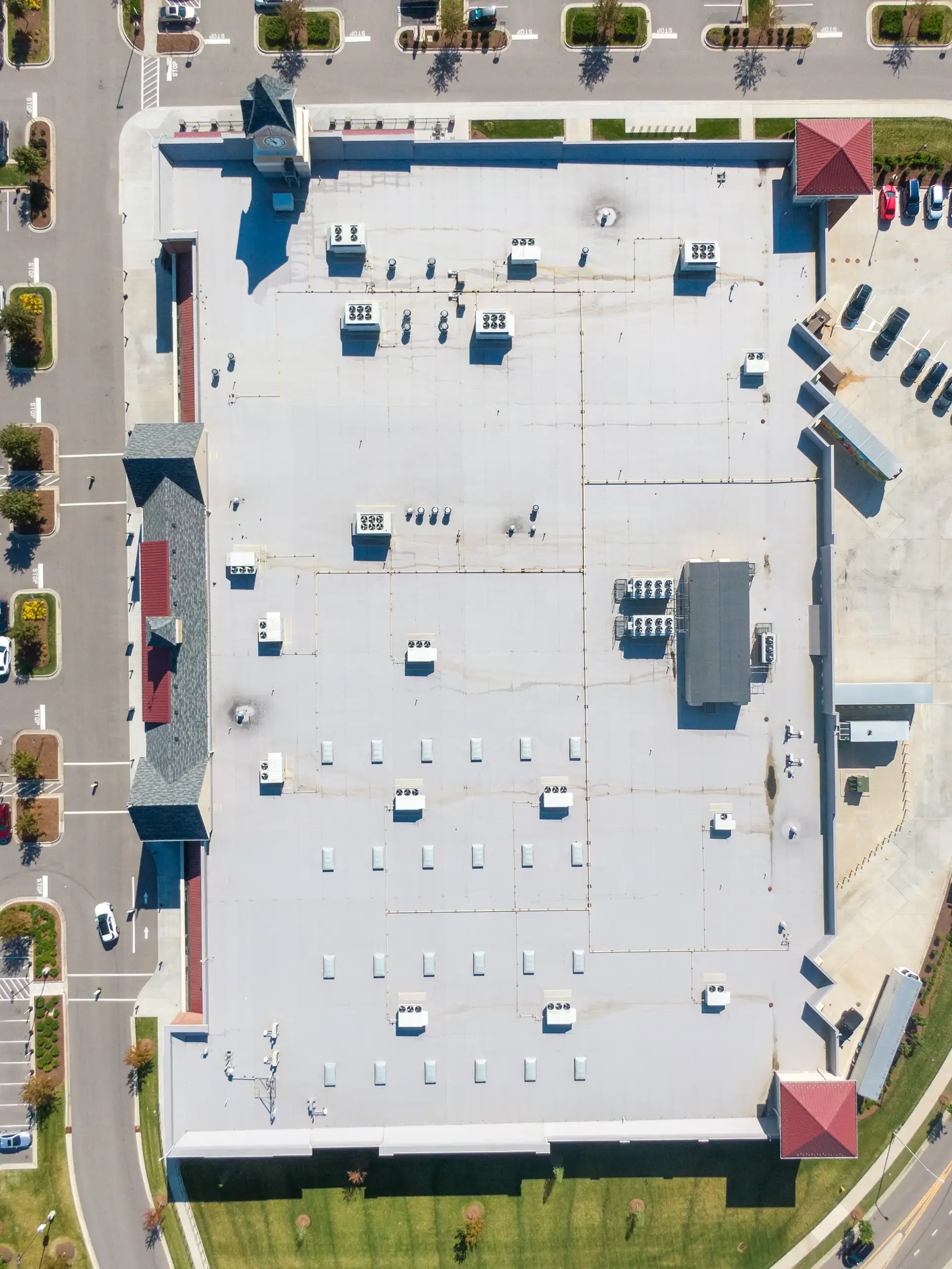
Aerial services built for your jobsite
From maps and models to high-resolution imagery, Skyland Pixels delivers the jobsite documentation professionals depend on.
Time-Lapse Documentation
High-resolution time-lapse videos. Stakeholder communication. Comprehensive project records.
Learn more →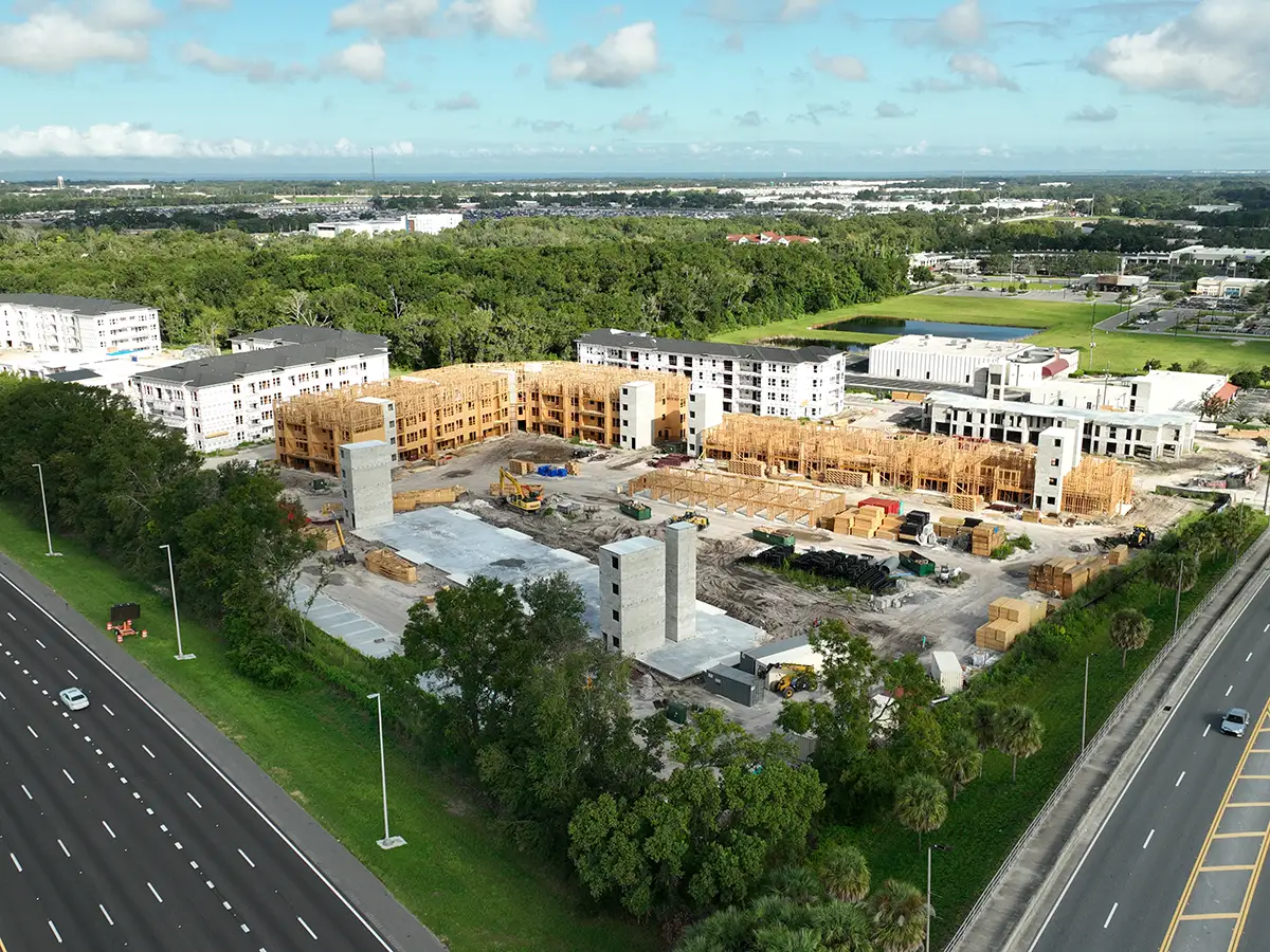
Construction Documentation
Aerial maps, orthophotos, 3D models, and progress visuals built for your jobsite.
Learn more →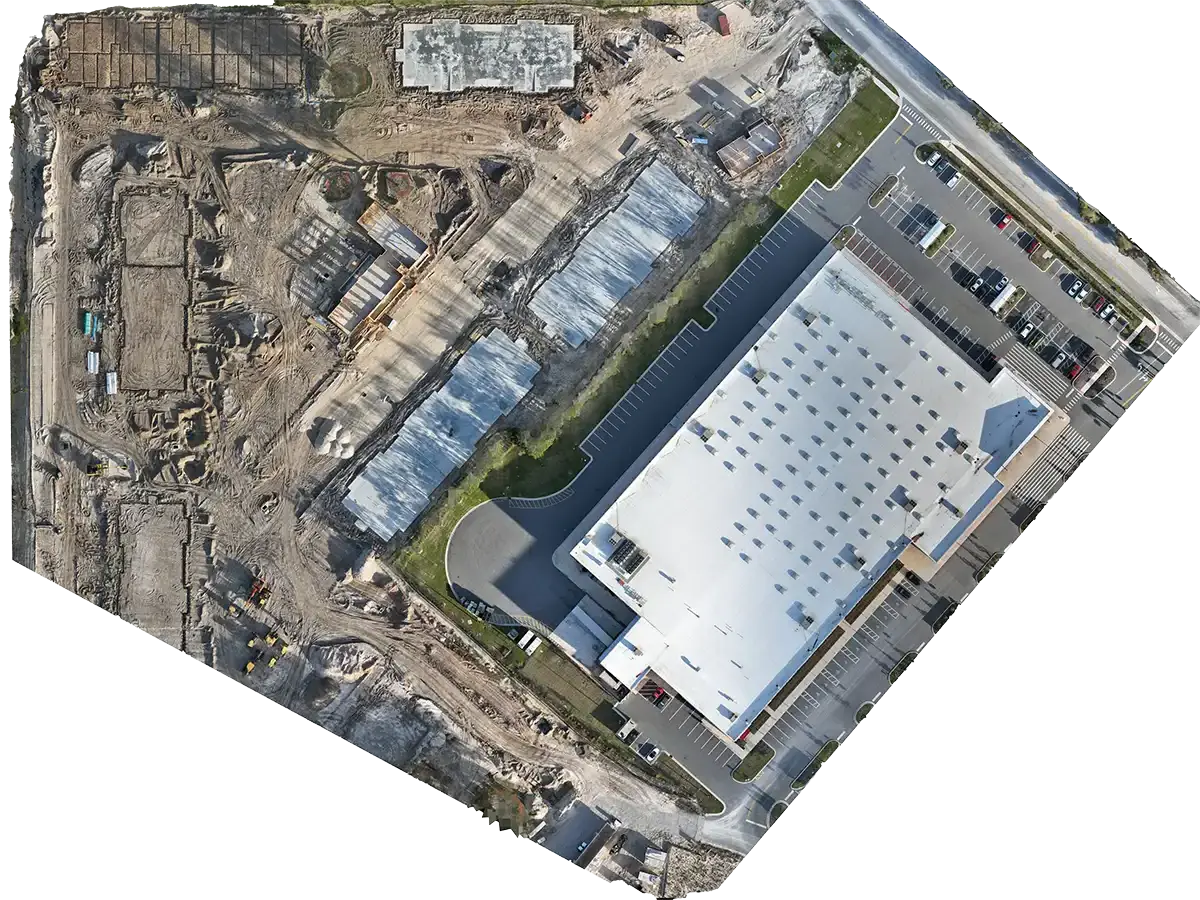
Progress Monitoring
Weekly or monthly scheduled flights. Same flight paths. Curated photo reports.
Learn more →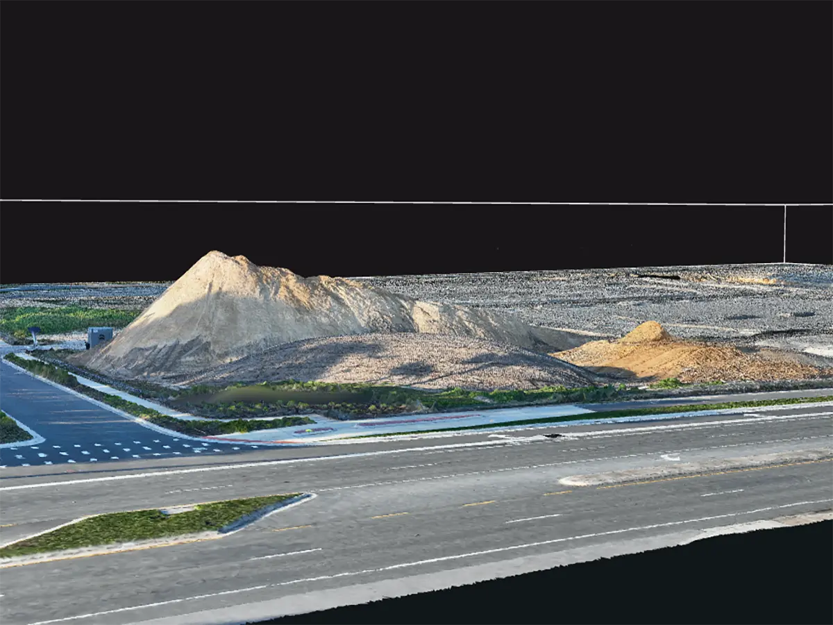
3D Modeling & Reality Capture
Dense point clouds, textured meshes, and orthomosaics. Drop into AutoCAD, Revit, or Civil 3D.
Learn more →Why construction teams hire us
Four reasons we make the cut for $5M-$50M commercial projects.
Precision & Accuracy
Our aerial mapping technology and quality control processes deliver exact measurements, orthophotos, and DSMs ensuring data you can defend in design reviews and to project stakeholders.
Local Expertise
We understand Central Florida's construction environment and permitting challenges, bringing real, location-specific insight to every project. We've worked the jobsites here.
Rapid Response
Fast jobsite mapping and 3D modeling. Our Orlando-based team deploys quickly to capture progress visuals and inspection data when you need it.
Comprehensive Reporting
Every service includes actionable reports: DSM/DTM maps, volumetric analysis, and high resolution documentation tailored to your stakeholders.
Pilot Program
Get your PM/Super 10+ hours back in 30 days, or don't pay.
We produce the visuals and the stakeholder report so your team doesn't have to. 3 pilot spots per month in Orlando.
- ✓ $1.5k pilot, 30 days
- ✓ Continues at $2k/mo monthly or $2.5-3.5k/mo weekly
- ✓ Eligibility: $5-50M commercial, ≥6 months remaining
- ✓ 48-hour turnaround, board-ready reports
What our clients say
★★★★★
"Chad is passionate and went above and beyond for our citrus mapping project. He delivered creative drone solutions and a detailed report that helped us get accurate acreage data. Highly recommend Skyland Pixels."
Zack Farr
Biotech Applied Research, Central Florida
★★★★★
"Working with Chad was a pleasure! He knows his stuff and gave me high-quality deliverables. He is professional and customer-focused. I highly recommend Chad for any of your aerial data needs."
Peter Morssink
3D Flight Maryland, Harford County, MD
★★★★★
"If you are in Orlando working in the construction space, Chad is your go to guy for all your aerial needs. Great communication skills and really understands the needs of his clients."
Michael Lilly
Wet Dog Drones, Deer Trail, Colorado
Serving Central Florida's construction community
Skyland Pixels proudly serves contractors, developers, and engineering firms throughout Central Florida. Our local expertise brings real, location-specific insight to every project.
Trusted • Certified • Committed to Excellence
We hold industry-recognized certifications that ensure every project meets the highest standards for safety, accuracy, and reliability.


Ready to see your project differently?
Book a 15-minute pilot kickoff. We'll confirm fit, lock your Week-1 capture date, and bring clarity to your project.
Book a Free Site Assessment